
Everything you need get off to a good start.
Brochures, guides, video tutorials, and live support—everything you need to create a successful audio guide, from the initial idea to publication.
Getting Started with the Editor
Frequently Asked Questions
Audioguides synchronized.
Audio editing
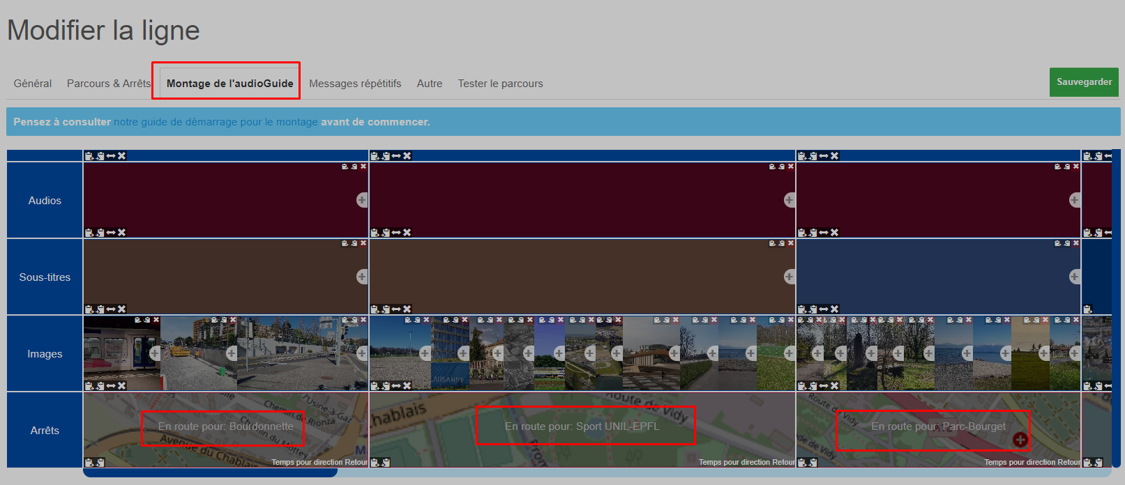
Once your route is created and your stops are placed, they will be displayed in the editing window:
To delete a stop, use the Routes & Stops tab (that is, the map where you drew the line)
What to consider before starting
Before you start, keep in mind that:
If you do not want to redo the editing for the opposite direction, leave the two-way option enabled and follow the instructions in this article: My line has two directions, what should I do?
It is important to choose the right option for your situation before starting, as an automatic two-way line does not offer the same possibilities as creating an AudioGuide for each direction.
In this interface, you essentially have four options for creating your montage:
The audios
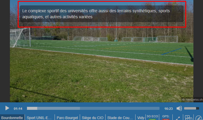
Here you can upload an mp3 file or record an audio directly, or even generate one with AI. It is possible to have multiple files, one for each chosen language, but also to have several files one after another, if for example you want to record something and then put some royalty-free music afterwards, etc., the possibilities are unlimited,
The subtitles
You can upload srt subtitle files or generate them with AI. However, remember to synchronize everything in your different languages, so that people speak at the same speed and the subtitles are synchronized.
Images & 360° Images
Images can be uploaded below, again, it is possible to have multiple images per stop/course or to use AI which can find real Creative Commons photos. You can even have different images depending on the language.
It is easy to add images, just upload them, or select from your library of already uploaded images.
For 360° images, they must be twice as wide as they are tall, you then need to check the appropriate option:
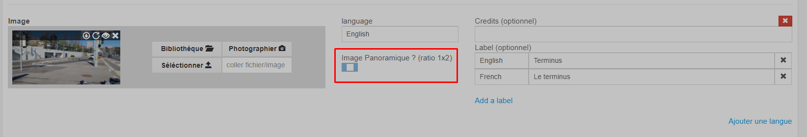
Feel free to also use labels that will display on the images depending on the language:
Stops
To name and configure the stops, you have the following options:
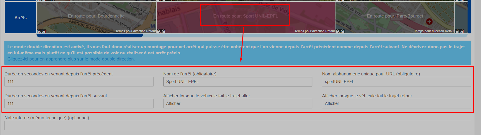
Some options are only available if you have activated the two-way mode.
The duration in seconds coming from the previous stop actually defines the duration of the journey to reach this stop from the previous one when GPS is not activated, this duration is ignored by GPS, because as soon as it arrives at the stop in question, it starts playing the following route. But this duration must still be well indicated for people not using GPS and especially to give you an idea of the average time it takes the vehicle to travel this route between the two stops. Indicate rather the average time, because if the vehicle takes more time (traffic jams, other), then the playback will stop in GPS mode and wait to arrive at the next stop to continue automatically. Note that the stopping time at the stops must also be taken into account, in the example in question, we have 100 seconds of travel and 11 of stop at Sport UNIL-EPFL.
For the duration in seconds coming from the following stop, this option is only displayed in two-way mode and is similar to its opposite option, here we come from Parc-Bourget and the journey also takes 111 seconds (which is unlikely, but it's just an example)
For the name of the stop, it is the name of the stop.
As for the unique alphanumeric name, it is used for your URLs, to start the journey at a specific place, it is not an automatically generated number, because all your URLs would then have to be redone if you were to add a stop one day in the middle of the line, therefore, you need to invent a unique name for each stop. This can consist of only removing spaces and accents.
Finally, the options to hide the stop are useful if you are using the two-way mode, that's why they are rather detailed in this article: My line has two directions, what should I do?
Additional editing tools
When editing your line, you benefit from additional tools, such as copy-paste or inversion, in case you create two projects for the same line, each project having its direction, you can then create one direction, then copy certain parts from one tab to another, and even automatically reverse images or audios or other.
Creating two projects is recommended when you want to describe the journey and not the stops, for example "On your right is a very pretty building but we no longer know what it is [...] on your right now is an even prettier building", as you can see, this audio describes a journey, it can therefore not just be reversed when the vehicle comes in the opposite direction, because right and left would be reversed. Moreover, in the opposite direction, the very pretty building is before the less pretty one, in short, you need two audio files, and therefore two projects. However, if you only describe the stops "at the next stop there is a very pretty building", then the two-way mode can be interesting. But if this is not the case, the additional editing tools will be very useful for easily creating the second direction in another AudioGuide open in another tab.
Ambiguous information?
Do not hesitate to contact us for training on our tools or for any questions or suggestions.
Synchronized audio guides for public transportation. A project NexSwiss Sàrl, Switzerland.